 In 1672 a major expedition to explore the American Midwest was authorized by Louis XIV. The purpose of the trip was to investigate and verify rumors of a water route from the Great Lakes to a "great river" that would lead to the sea at New Orleans. The impetus for the exploration was the reports of early French scouts that there were important copper deposits4 near Lake Superior. The fur trade was already well established and could be managed using canoes back east through existing water routes and portages, but for heavy copper ore, a water level route was required. Louis Joliet was selected to lead the exploration. Jacques Marquette, a Catholic priest, was sent along as the spiritual leader. Marquette had a zealous ambition to evangelize the native Indians, stating at the end of his voyage; "Had this voyage resulted in the salvation of even one soul, I would consider all my troubles well rewarded."5
The route of the voyage led down Lake Michigan to Green Bay, and then via the Fox and Wisconsin Rivers to the Mississippi. The portages were long and the trip was arduous. It was hardly an acceptable trade route. The party of eight adventurers went as far down the Mississippi as the Arkansas River, then turned around, fearing that all of the valuable information they had gained could possibly be lost if they were slain by hostile Indians or if they were captured by the Spanish, enemies of France who had recently taken control of Louisiana.
The route back was easier as they would be meeting friendly Indians with whom they had exchanged gifts on the way down. Some of the Native Americans had already been converted to Christianity by Father Marquette. Some Kaskaskia6 tribe members helped direct them to the much shorter and easier route back to Lake Michigan via the Illinois and the Des Plaines Rivers, up a short creek to Mud Lake, into the Chicago River and on to Lake Michigan. Mud Lake extended from about Harlem Avenue on the west to Kedzie Avenue on the east. In times of spring flood, the Des Plaines would overflow into Mud Lake and flow to Lake Michigan. In dryer weather, portages would be required. On about September 1, 1673,7 Louis Joliet and Father Marquette were the first Europeans to use what came to be called "The Chicago Portage."
Both copies of Marquette's journal were lost, but detailed descriptions of the trip survive in Joliet's notes, in messages sent home, and in reports by contemporaries with whom they discussed their trip. Joliet clearly understood the significance of the Chicago Portage. The following year, 1674, he sent back a report stating; "It would only be necessary to cut a canal through half a league of prairie (one and one-half miles) to allow easy navigation from Lake Erie to the Gulf of Mexico."8 It would, of course, be found to be enormously more difficult.
The second great French exploration was by René Robert Cavelier, Sieur de la Salle. His purpose was different from Joliet's. He was charged by Louis XIV in 16799 to take possession of the Mississippi Valley in the name of the King of France. After some tentative explorations in Southern Michigan and Northern Indiana, La Salle arrived at the Chicago Portage in late 1682.10 Three months later, he and his group of twenty-two were at the mouth of the Mississippi, and claimed the entire area for France.
 The first true settlement of Chicago by Europeans was Fort de Chicago, built by French Jesuits in 1683.11 The Fort served as a French outpost until it was abandoned in about 1705. During this period there was extensive use of the portage by traders, as beaver pelts passed through on their way to Paris. The portage was an easy route, especially for the trappers. Their usual routine was to go west in late summer or fall, spend the winter and early spring in the territories, and return with their skins in spring.12 At this time of the year, the portage was usually in flood, with the Des Plaines flowing both into its valley to the south, and over the continental divide into the Chicago River. Thus it was possible to paddle the whole way between the two river systems. Even in the early 1800s there are descriptions of boats of 15" draft and weighing six tons being able to navigate across the portage in spring.13
The colonies in the east were coalescing into a union. The French were withdrawing, but their influence would remain. A major contribution of the French was to give names to the main features of the portage. Illinois, the state and the river, was ininiok and then illiniwek, names for the confederacy of six Native American tribes which occupied the area.14 This was changed by the French to Illinois. The name of the Des Plaines River is a corruption of eau plein, "full of water"15, referring not to the river, but to the sap-flowing maple trees along its banks. The portage was occasionally referred to as Portage des chênes, after the many oak trees near Mud Lake. Later it came to be called le portage de Checagou16 after the wild onions that grew in the area. Chicago was named after the portage, not the other way around.17
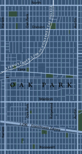
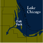
Native Americans had occupied the area for five hundred generations18 -- over ten thousand years. They had, of course, been using the portage for a long time and created sophisticated trade routes, stretching all the way to Florida.19 Trails from the portage led east and west and also north, along the old beach ridge, to and through Oak Park.
Native Americans reestablished control of the area of Illinois in about 1700.20 For the next hundred years there was very little traffic on the trade route.21 During this time, the portage would be under three flags: France, England, and the United States. The British took control from the French in 1763.22 The newly formed United States gained the land by the Treaty of Paris in 1783,23 which ended the Revolutionary War. In 1779, the first permanent local European settler, Jean Baptist Point du Sable, built a cabin on the Chicago River near Lake Michigan.
The Treaty of Greenville, between the U.S. and Native American tribes, created peace in the area, and the U.S. took a parcel of land, six miles square, at the mouth of the Chicago River.25 Fort Dearborn was built in 1804,26 and generally secured the area except for a massacre and destruction of the fort in 1812. In 1816 Territorial Governor, Ninian Edwards, negotiated a treaty with the Native Americans, taking control of a strip of land twenty miles wide from the mouth of the Chicago River to the Illinois River, and then ten miles wide to the Fox.27 The northern border of this strip still shows as Forest Preserve Drive adjacent to Indian Boundary Golf Club in Norridge.28 Finally, in 1832, with the Treaty of Chicago ending the Black Hawk War, Native Americans left Illinois completely.
Bill Dring, author
Written June 1998. Revised November 2002, January 2007, December 2020. Revised October 2021 by Deborah Mercer.
All maps designed by Dennis McClendon, Chicago Cartographics
For more information on the I&M Canal, follow this link to the next webpage.
For more information on the Continental Divide, follow this link to our webpage.
For more information on the Chicago Sanitary and Ship Canal, follow this link to our webpage.
To return to the main exhibit page, follow this link.