The need for an all-water trade route became obvious after Thomas Jefferson's Louisiana Purchase in 1803. The promise of great lands was confirmed by the reports brought back by Lewis and Clark in 1806, leading to a flood of migration to the west. An additional water route was needed, and Congress commissioned a study for a canal to replace the portage. In 1818, Illinois became a state. At that time the state's northern border, originally intended to be near the south tip of Lake Michigan, was moved many miles north so that the entire potential route of the canal would be in a single jurisdiction.29
The report to Congress in 183330 is full of enthusiasm (and hyperbole); "There is not, perhaps, on the face of the globe, a place where such a mighty physical revolution could be produced with so little human labor."31 An Illinois and Michigan Canal was proposed, at an estimated cost of $4,299,43932, which later grew to a construction cost of $6.5 million.
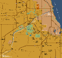 The I&M Canal, as designed, was to run from the Chicago River at Bridgeport southwest over the continental divide and then parallel to the Des Plaines River, finally meeting the Illinois River at La Salle Peru, where the Illinois River became fully navigable. The canal would be ninety-six miles long, sixty feet wide, and six feet deep. The locks were to be one hundred ten feet long by eighteen feet wide33. Fifteen locks woul be needed to accommodate the one hundred fifty foot drop34 from Bridgeport to La Salle. There were aqueducts to allow the canal to pass over the Fox River and over smaller streams.
To feed the canal and operate the locks, water was to be supplied from many of the rivers and streams along the route. Water was also to be pumped into the canal from the Chicago River, which induced a slight flow out of Lake Michigan in dry weather.35
To pay for the canal, the U.S. Congress gave the State of Illinois 235,000 acres in the form of alternate sections of land in checkerboard fashion,36 to be sub-divided and sold. It must have been slow going. The highest price paid in the first sale was $10037 for an 80-by-180-foot lot on the river in downtown Chicago. Work on the canal began in 1836 and finished in 1848. The canal was an immediate success and in 1882, traffic peaked at over one million tons,38 more than the combined shipping total at the ports in New York, San Francisco, and New Orleans.39 The section of the canal that flowed through Chicago was covered over by the construction of the Stevenson Expressway. However, between Channahon and Ottawa much of the canal remains, with the towpath providing a delightful hiking and biking trail.
Bill Dring, author
Written June 1998. Revised November 2002, January 2007, and December 2020. Revised October 2021 by Deborah Mercer.
All maps designed by Dennis McClendon, Chicago Cartographics
For more information on the Chicago Sanitary and Ship Canal, follow this link to our webpage.
For more information on the Continental Divide, follow this link to our webpage.
For more information on the Chicago Portage, follow this link to our webpage.
To return to the main exhibit page, follow this link.