When we usually think of the continental divide, we think of the mountain-top spine which runs the length of the Rocky Mountains. Every point of crossing is marked with a sign announcing the divide, as if from here, all rivers flow either west to the Pacific Ocean or east to the Atlantic Ocean.
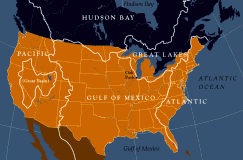 But the geography is actually not quite that simple. In fact the United States land area is divided into several distinct basins flowing, respectively, into the Pacific, the Atlantic, the Mississippi River into the Gulf of Mexico, Canada's Hudson Bay, and of course the Great Lakes which drain into the St. Lawrence River and hence into the Atlantic.
The lines separating each of these great basins is a continental divide and one of these continental divides runs right through the middle of Oak Park. On the west side of our divide, waters flow to the Des Plaines River in River Forest, down to meet the Illinois River near Joliet, to the Mississippi, and finally on to the Gulf of Mexico. On the east, before the reversal of the Chicago River , the water would flow to the Chicago River, into Lake Michigan and through the Great Lakes -- Huron, Erie, over Niagara Falls into Lake Ontario, and finally to the St Lawrence in Canada and into the north Atlantic.
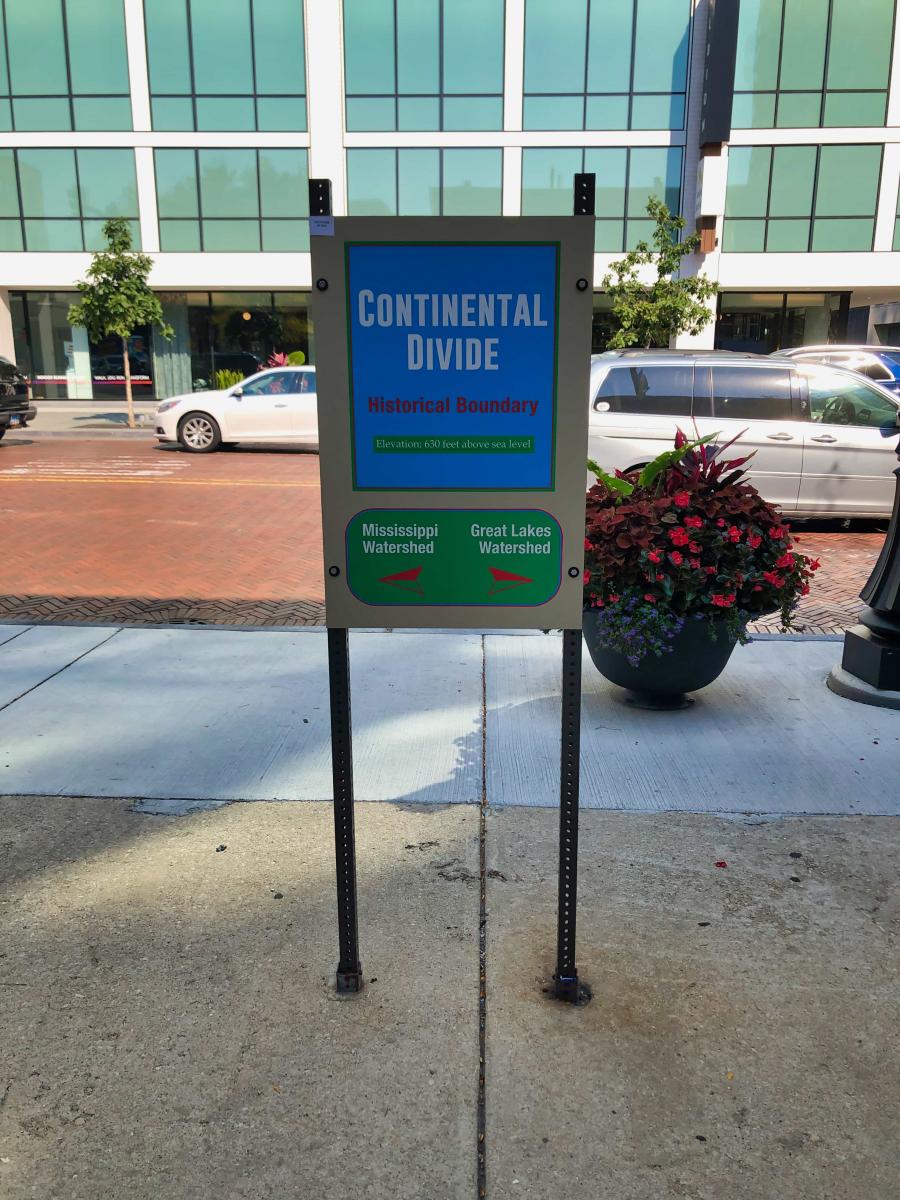
Oak Park marks the Continental Divide
In Oak Park there is a ridge which runs just west of Ridgeland Avenue through Taylor Park, to near Scoville Park, and then west to Downtown Oak Park. This ridge, called the "Oak Park Spit," is an ancient beach. The beach was formed in glacial times--12,000 years ago--when the whole area to the east and north was covered with ancient Lake Chicago. The lake was formed by the melting glaciers. The outlet to the north was blocked by ice and the lake rose until it found a point where it could flow over the low divide and into the valley of the Des Plaines and Illinois Rivers 1.
The terrain in our village is so flat that the slopes are difficult to perceive. The best place to see a distinct drop off in both directions is at the northwest corner of Taylor Park, at the intersection of Berkshire and Elmwood. There you will be standing on the continental divide. At the time this area was first settled, the land east of Oak Park, being an old lake bottom, was mostly swamp. Our low ridge was the first high land west of the Lake and was a desirable place to build. Thus in 1837 Joseph Kettlestrings--the first person to purchase land in what is now Oak Park--chose to build west of Oak Park Avenue, on top of the ridge. The oak trees, growing on the sandy ridge, gave Oak Park its name 2.
The fact of the divide is more than a mere geographical curiosity. Along the entire length of the divide, there is a point just five miles south of Oak Park which provides the most desirable point of crossing.3 Here, near Summit, and near the Village of Lyons, the low height of the divide and the short distance between streams on either side made it relatively easy to portage canoes from one water system to the other, facilitating travel from the east coast to the Mississippi River. Thus an important trade route was established, the very reason for founding a city here.
In reversing the flow of the Chicago River, the Continental Divide no longer functions as it did historically. The water still divides in Oak Park, but all water runs to the Gulf.
Bill Dring, author
Written June 1998. Revised November 2002, January 2007, and December 2020
All maps designed by Dennis McClendon, Chicago Cartographics
For more information on the Chicago Portage, follow this link to the next webpage.
For more information on the I&M Canal, follow this link to the next webpage.
For more information on the Chicago Sanitary and Ship Canal, follow this link to the next webpage.
To return to the main exhibit page, follow this link.